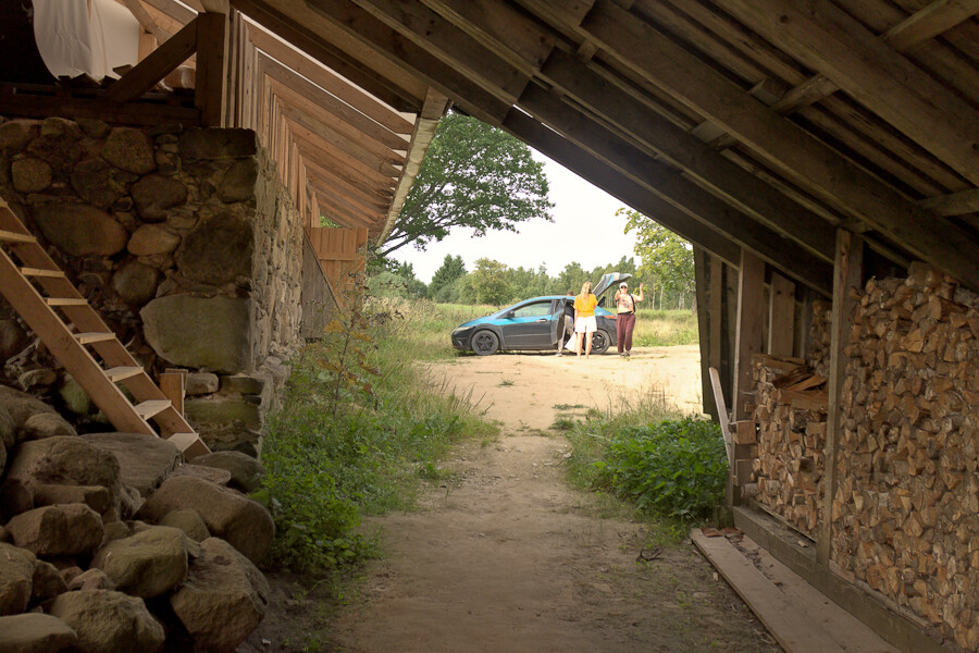
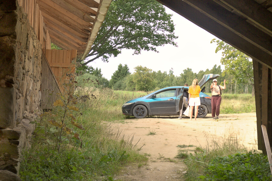
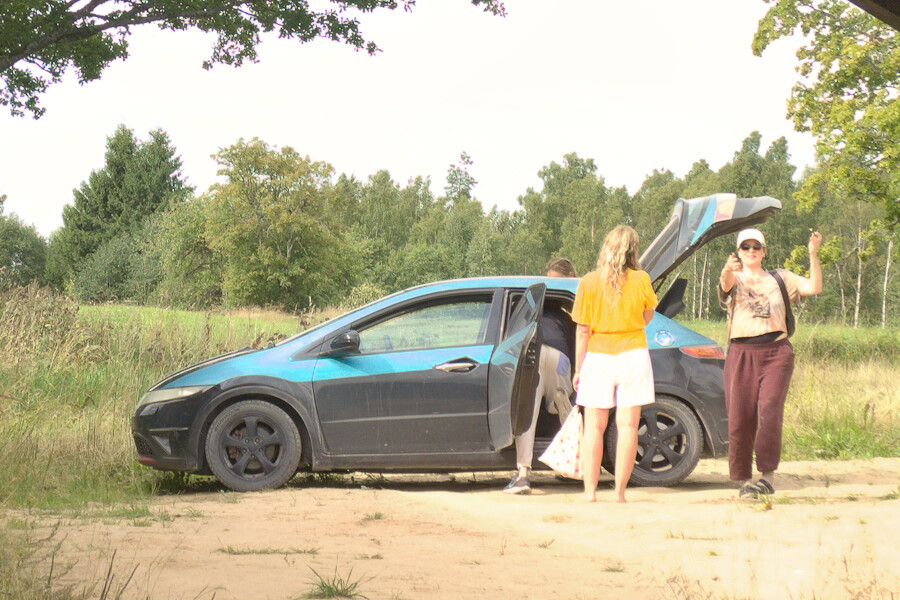
Departure.
Savvaļa, Latvia, August 2026.
Happy how this turned; though you need to be able to zoom in and back out to truly appreciate - as in to wa
Altro...
Departure.
Savvaļa, Latvia, August 2026.
Happy how this turned; though you need to be able to zoom in and back out to truly appreciate - as in to walk inside the picture - so I'm posting it as series. :)
So kind of trying to escape the two-dimensionality of a photograph by this presentation. :)
It's a bit longer since I posted here last time; I was basically too busy surviving. But now I have also a bunch of new film photos. Hopefully will soon have enough time to work on them.
#photography #depth #spatial #dimensions
#savvala #departure
#photography
#depth
#spatial
#departure
#dimensions
#savvala
Impact Of Urbanization Driven Land Use And Land Cover Change On Ecological Environmental Quality In Rupandehi Nepal Assessed Using The Remote Sensing
Altro...
Impact Of Urbanization Driven Land Use And Land Cover Change On Ecological Environmental Quality In Rupandehi Nepal Assessed Using The Remote Sensing Ecological Index
H/T@ Gaurav Parajulim
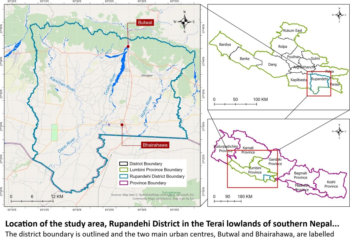
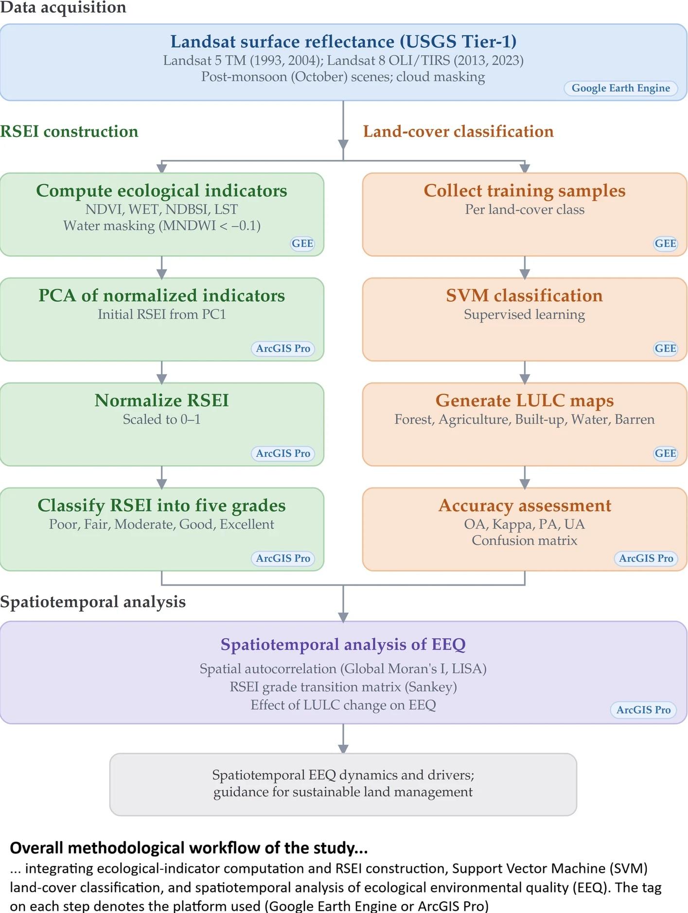
“[The authors] studied how the ecological quality of Nepal's Rupandehi District has changed over three decades (1993–2023), using satellite imagery and the Remote Sensing Ecological Index (RSEI) to track the health of the landscape year by year and to understand how urbanization-driven land use change has reshaped it.
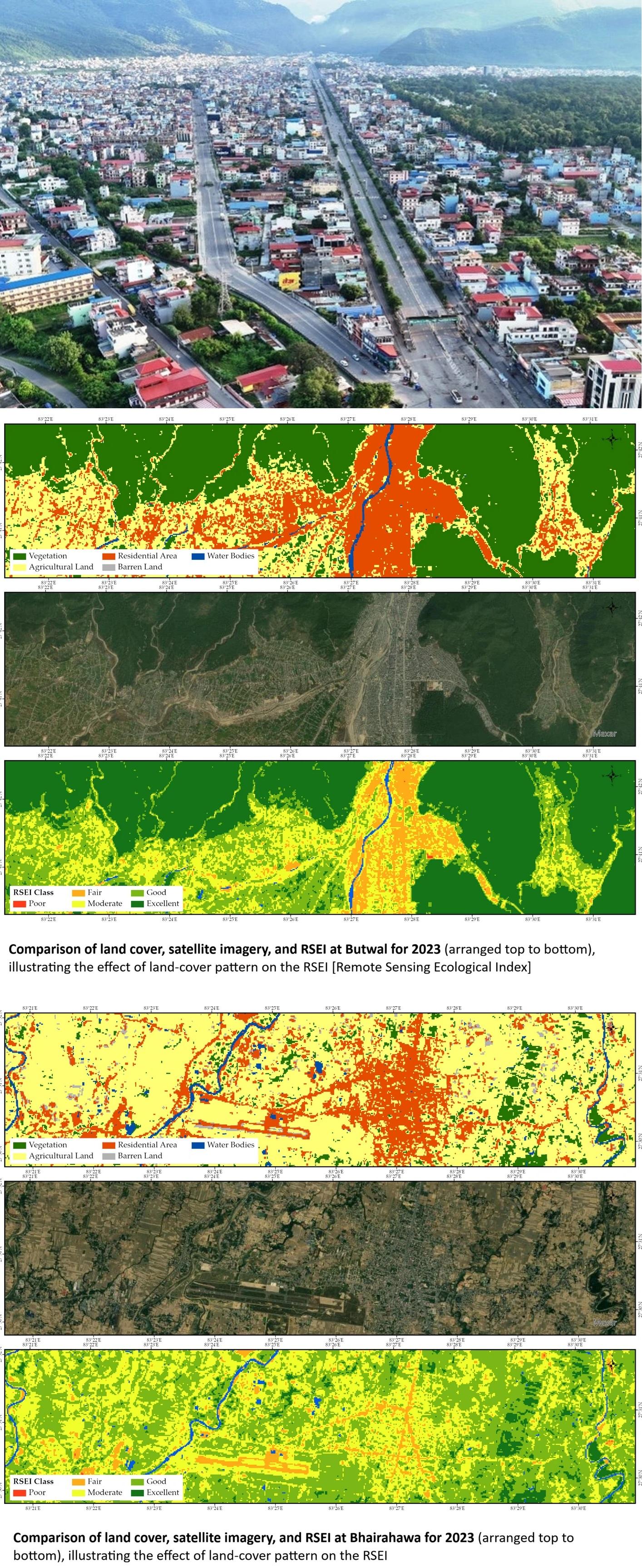
What [they] found tells a nuanced story: as Butwal and Bhairahawa grew and built-up land expanded, ecological quality shifted in ways that a single number can't capture, some areas recovered, others declined, and the patterns rarely moved in a straight line…”
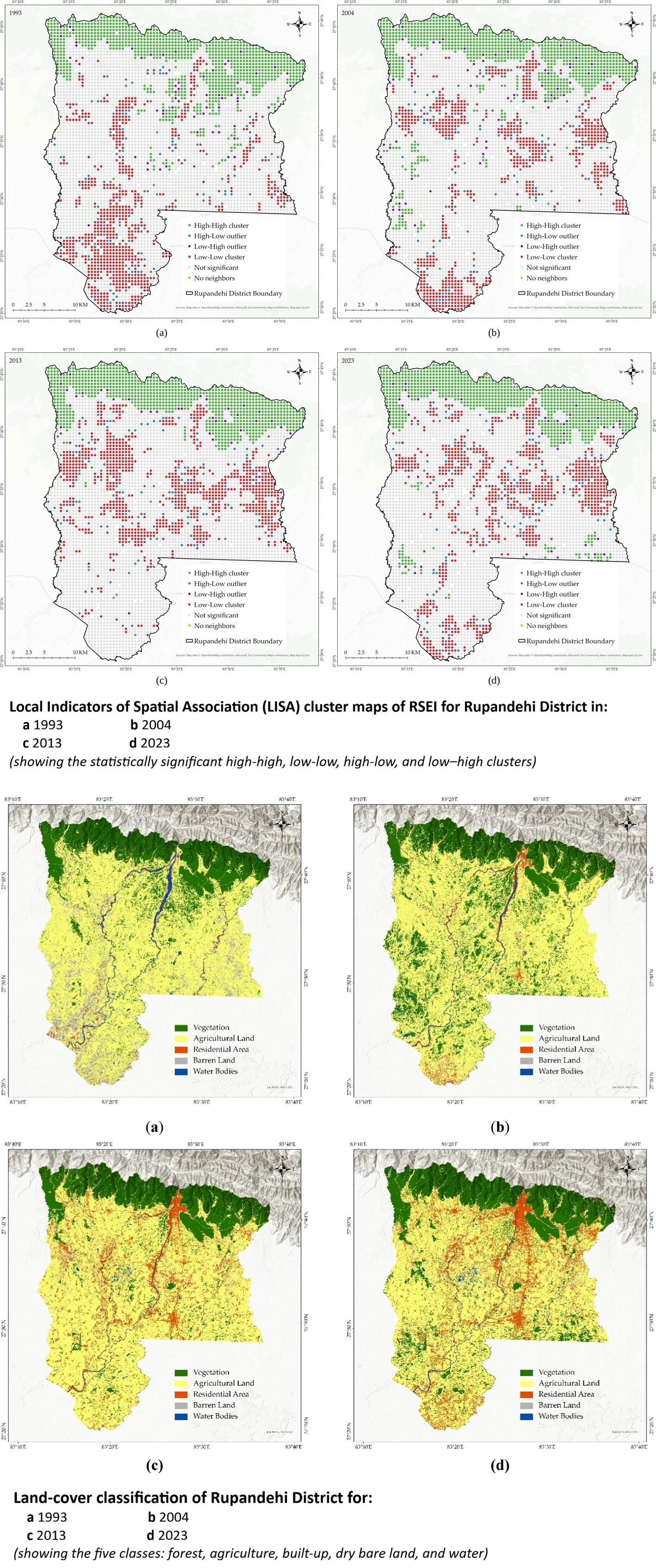
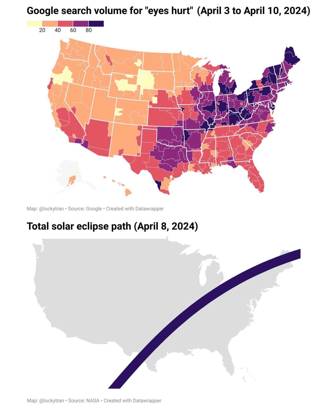
“Rapid urbanization and population growth are major drivers of land use and land cover (LULC) change and can substantially alter ecological environmental quality (EEQ). This study assessed the spatiotemporal dynamics of LULC and their effect on EEQ in Rupandehi District, Nepal, over a 30-year period (1993–2023). Four ecological indicators representing greenness, wetness, dryness, and heat were derived from Landsat imagery in Google Earth Engine (GEE), and LULC was classified using a Support Vector Machine (SVM). The Remote Sensing Ecological Index (RSEI) was then constructed from these indicators using Principal Component Analysis (PCA) in ArcGIS Pro, and its spatial structure was examined using global and local spatial autocorrelation. The mean RSEI followed a non-linear trajectory, rising from 0.59 in 1993 to 0.635 in 2004, declining to 0.55 in 2013, and recovering to 0.67 in 2023, indicating an overall improvement in EEQ with a temporary mid-period decline. Over the same period, built-up areas expanded substantially and agricultural land declined, whereas forest cover fluctuated but showed a slight net increase by 2023, and barren land decreased markedly. Higher EEQ was concentrated in the forested northern hills, while lower values occurred in the urban centers of Butwal and Bhairahawa, closely matching the spatial pattern of LULC change. The results indicate that ecological quality reflects the combined influence of all land cover classes rather than any single class. This study provides a transferable and reproducible workflow for long-term ecological assessment based on openly available Landsat data, with the analysis code shared in a public repository, offering practical guidance for sustainable land management and environmentally responsible urban development...”
#GIS #spatial #mapping #RemoteSensing #GIS #RSEI #EnvironmentalMonitoring #Nepal #Research #GoogleEarthEngine #ArcGIS #EcologicalQuality #spatialautocorrelation #ecology #environment #earthobservation #RemoteSensingEcologicalIndex #landscape #urbanisation #urban #development #landuse #change #spatialanalysis #spatiotemporal
#landscape
#urban
#ecology
#environment
#research
#gis
#spatial
#mapping
#spatialanalysis
#remotesensing
#rsei
#environmentalmonitoring
#nepal
#googleearthengine
#arcgis
#ecologicalquality
#spatialautocorrelation
#earthobservation
#remotesensingecologicalindex
#urbanisation
#development
#landuse
#change
#spatiotemporal
#google
#eclipse
#damage
#gis
#spatial
#mapping
#solareclipse2024
#eclipse24
#spatialanalysis
#demographics